

Eric B
-
Posts
3,467 -
Joined
-
Last visited
-
Days Won
1
Content Type
Profiles
Forums
Gallery
Downloads
Events
Blogs
Posts posted by Eric B
-
-
It seems all those interactive screens they had are gone now. This map would have been a good use forthose. When I used to see them, I had wished there was something like this. I wonder why they got rid of them, and only put up all these non-interactive screens.
0 -
But there's going to still be merging anyway. Keeping trunk lines together will not solve the problem enough to justify the limited direct access it would leave.
1 -
No, not the actual tunnel width; they just added stuff (cables, equipment, etc.) that narrowed the clearance.
With all this talk of deinterlining Gold St. Iseemingly inspired by then deinterlining the IND uptown, one difference is that the uptown change basically consolidated operations, so that the
") and
and ") and
and ") and
and ") start and dinish in nearly the same places, and use the same yards on both ends. As far as the crews, each terminal on the branches are also consolidated into the same "section" or "district" (i.e. "North", "South"). With the BMT South,
start and dinish in nearly the same places, and use the same yards on both ends. As far as the crews, each terminal on the branches are also consolidated into the same "section" or "district" (i.e. "North", "South"). With the BMT South, ")
")
") all have the same yard at one end (and the
all have the same yard at one end (and the ") uses it too), and are in the same district, so it's already consolidated like that. (And the and are there too, but moving them around on that end won't really change anything in that regard).
uses it too), and are in the same district, so it's already consolidated like that. (And the and are there too, but moving them around on that end won't really change anything in that regard).
I guess the sole benefit of these isdeas is trying to avoid the slowdowns where they come together at Gold St? I don't think that by itself is worth changing up the lines. For one, a lot of the delay is because it seems they now basically stop everybody at that interlocking to ask who they are (i.e. "spot"). They already had cameras there (at least southbound, when I used to be over there, 11 years ago), but it seems they don't even want to trust those anymore (and they even less trust punches). All of these "backup" measures, piled on top of one another!
They need a better way of the tower people knowing for sure what is what (it's already on the now computerized train registers), and also schedule it better so that trains trying to get to the same line (either way) aren;t arriving at the same time. (Which seemed to happan a lot).It's nice to have direct access to different trunk lines on the outer branches. Also, on the uptown IND, one interlined service was rush hours only, while the other only served two local stops (weekdays only) and ended, so it wasn't as big a loss as what is being suggested for the entire BMT South.
2 -
Wow; I didn't even notice that! (nor the zigzag). I was just so exceited at the idea of something like this finally being out! Hope they fix it soon!
0 -
That was the test for LED lighting.
0 -
COOL! (Saw it on NY1). It's based on the regular map, and so has a single line for each route, so both directions are on the same line. THis is something I ghad long ago envisioned track maps for, so I wish either Peter Dougherty, Vanshnookraggen or RMarrerro would offer their maps to MTA to be used for this!
1 -
3 hours ago, Union Tpke said:
This issue is why the K bullet was moved next to the B

Because the
") (the former AA) was interlined with the , so that the same trains changed back and forth between the rush hours and other times. So they put them next to each other on the signs so it would be quick to change. Those signs are arranged by lines that are close to each other and might interchange like that.
1
(the former AA) was interlined with the , so that the same trains changed back and forth between the rush hours and other times. So they put them next to each other on the signs so it would be quick to change. Those signs are arranged by lines that are close to each other and might interchange like that.
1 -
Gee whzs; RGB's are easy to get nowadays. Why would they use on a computerized train a makeshift setup made to hook up to an existing (no longer used) "off/on" switch on the older trains?
0 -
Myrtle-Wyckoff is up and running! (Was still dark going to work, but fully operational going hime. Now if only they gave us passes that used them! Seemed like they weren't even thoght about over here until very recently. So is the southern section now going to be the last?)
0 -
Just saw them at Myrtle-Wyckoff!
0 -
Actially, the
briefly ran to Euclid Avenue, Brooklyn in January, 2005 when a fire at the Chambers St. relay room knocked out the switches in the area, making it impossible for the to run to Brooklyn. There were some 160's that ran on the line. They include a lot of hypothetical routings, just in case, including still havignt he line on there even if it's not running now.
0 -
I liked some of the things they were doing in that area. The Q39 is a very long winding route, and the replacements were a bit more direct, from what I remember (need to look at the map again). Including getting it off of Fresh Pond, anc cutting across the little streets between Eliot and Rust, which is something I had always thought of. Though at one of the hearings, people were complaining that the buses might not fit, and so they were goign to check that out. I think it's still better than going out of the way to the congested Fresh Pond.
0 -
Like to know myself, but it apparentely hasn;t been drawn up yet, and that's if they don't get the funds they're asking for.
0 -
6 hours ago, B35 via Church said:
M1: IDK what that area around Foley Sq. is considered, but Centre/Worth is not TriBeCa.... That would be pretty egregious if they did that.
Probably Manhattan Civic Center. (That's basically what it is. For historical trivia, over 100 years ago, it was the infamous "Five Points", and before that, "the Collect", from the pond they built over, and is now represented by that murky pool next to the family court)
2 -
All I seem to be seeing mentioned now is hybrids. Have they given up on pure electric again? I see the Proterras out everyday, but are they doing bad or something?
0 -
12 hours ago, Lawrence St said:
hat the
") would be eliminated fully. I can also see them eliminating
would be eliminated fully. I can also see them eliminating  and
and  service and also cutting the
 ") to 96/2 at all times. I think that MTA has gotten so far along East Side Access that they have to finish it. I'm not sure Metro-North goes to Penn Station ever.
12 hours ago, Lawrence St said:
to 96/2 at all times. I think that MTA has gotten so far along East Side Access that they have to finish it. I'm not sure Metro-North goes to Penn Station ever.
12 hours ago, Lawrence St said:They actually want to delay the start of East Side Access.
I could see the
just returning to Chambers St full time...
10 hours ago, R10 2952 said:@Lawrence St Honestly, passengers will be lucky if the
") goes past Myrtle when all this is done and over with.
8 hours ago, R32 3838 said:
goes past Myrtle when all this is done and over with.
8 hours ago, R32 3838 said:I doubt that would happen, The politics in the Middle Village area would make sure of that. Out of all the Cuts, That would be the dumbest cut to make.
Judging by the Essential Services plan, it seems to be the other end of the line that holds the most sway now, as the
wasn't reduced at all (except slight headway changes), so I could see it being the same.
1 -
5 hours ago, Amtrak41 said:
They really snubbed the former BMT Eastern and Southern Divisions in Brooklyn and Queens, though they did the IRT and IND to Euclid. Red haired stepchildren Crosstown, recaptured BMT Culver, Lefferts, and the Rockaway operation also left to last.
I call the big "0" in the middle the "Cipherzone" (for numerous reasons, such as never being rebuilt to handle 75 foot cars, and thus not being able to get any new equipment for 30 years; being so isolated since they tore down the Myrtle el, and before the
was sent up 6th Ave.; poorly connected to Queens by bus, etc. and now, there being no sign of any new far system even being though of in the area), but now these other areas are in the same boat (both of them, on the very edges. The area in the middle is in many ways like an outskirt, as it originally was when Brooklyn was its own city.
0 -
On 8/5/2020 at 9:43 PM, mikecintel said:
Now there a detail mapped about OMNY and it is till the end of August till early September installations:
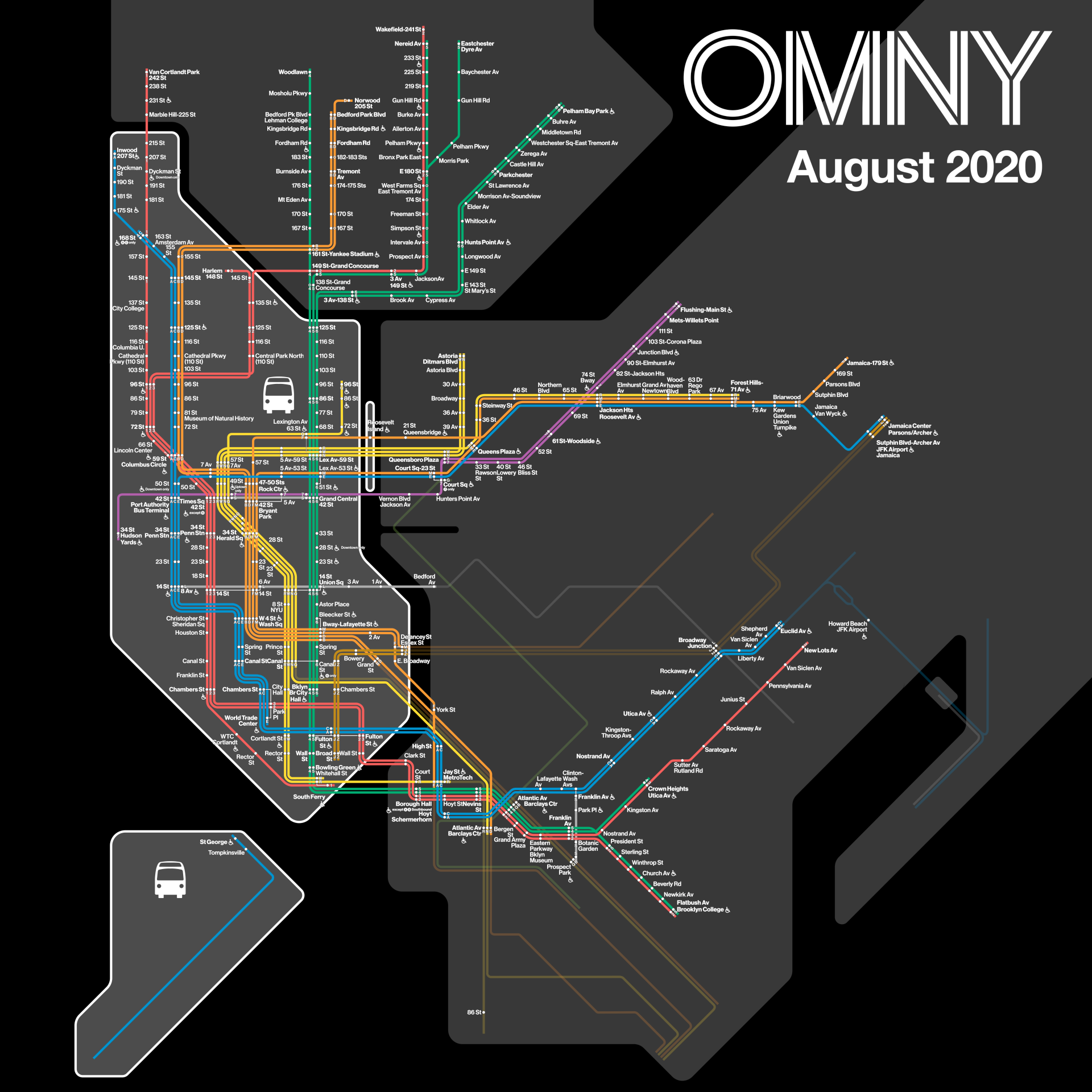
Looks like after August FINALLY Brooklyn is next and then it should be all completed and it should be OMNY wide. Then MTA should introduce the NEW MTA own OMNY card. Waiting a long time for that. Don't want to keep using my credit card for OMNY. It's convenient YES but still prefer MTA own OMNY card so my bank info does not have to be in their system if you know what I mean..
Wonder why Brooklyn is always last (IIRC, it was the same pattern with Metrocard. Manhattan and Staten Island first, then the Bronx and I think Queens)
0 -
Looks like some version of Helvetica.
0 -
They were mostly
") and
and ") . I did see one on the during the blizzard of '83.
3
. I did see one on the during the blizzard of '83.
3 -
11 hours ago, Calvin said:
4790-4791 (with special custom A signages), 4796-4797, 4798-4799, 4816-4817, 4806-4807 are at Coney Island Yard. Prep to become work trains.
Why would they use 32's and not 32's, since they have the more durable bodies. The 42's will continue to have the rusting problems.
0 -
Cool; so now Flatbush has a route into Manhattan!
I want to fan this one, but it would be hard to be up that late, and then have to get home from there!
I used to imagine an "NYC100" that would run from 110th, down 5th Ave, Bowery, and then down Flatbish to the Junction.
1 -
Wow; I missed it (heard about the route, but didn;t even know what it was or when it would start, and thingt it was just a proposal, until these last few posts).
So (sorry if it was discussed earlier) what kind of buses does it use (express or local), and which depot is it based out of?
0 -
10 hours ago, NewFlyer 230 said:
I feel like the
and lines will be last in general to have OMNY at all its stations. I can see Metropolitan Ave to Myrtle Ave-Broadway on the getting it before all stations between Alabama Ave and 121street on the .
This whole area looks like it will be last. There's no sign of it anywhere; like it's not even being thought of. Trying to remember if we were among the last to get Metrocard.
0
") (the former AA) was interlined with the
(the former AA) was interlined with the ") goes past Myrtle when all this is done and over with.
goes past Myrtle when all this is done and over with.
MTA launches real-time first-of-its-kind 'live subway map'
in New York City Subway
Posted
But with this new map, they would likely be more used!